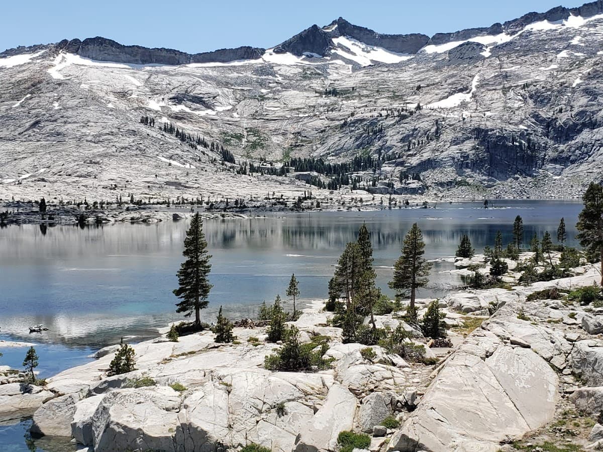
Lake Tahoe Region
Crystal-clear alpine lake straddling California and Nevada's border
Lake Tahoe sits at 6,225 feet, straddling the California-Nevada border like nature's own masterpiece. This isn't just another mountain lake — it's 22 miles of crystal-clear water so pure you can see 70 feet down on a good day. The lake formed 2 million years ago, carved by glaciers and volcanic activity, creating what Mark Twain called "the fairest picture the whole earth affords."
Here's what makes Tahoe special: you get two states, four distinct seasons, and everything from world-class skiing at Heavenly to summer beach days at Sand Harbor. The North Shore leans more family-friendly and outdoorsy, while South Lake Tahoe brings the casinos and nightlife. But honestly? Both sides deliver that alpine magic that keeps people coming back year after year.
Culture & Context
CASINO BORDER, OUTDOOR REVERENCE
Lake Tahoe sits on the California-Nevada border at 6,225 feet, and that state line does real work. Cross from South Lake Tahoe into Stateline, Nevada, and the casinos start immediately. California keeps the crunchy outdoor vibes; Nevada keeps the late-night options.
The lake itself is the anchor for everything. It's 22 miles long, 12 miles wide, and so deep it never freezes. People here are obsessed with it in the way people who live near the ocean get about the ocean.
Skiers, mountain bikers, kayakers, trail runners — they all share the same roads and the same reverence for the water. But here's the thing: it's also genuinely expensive to visit, and that can be a shock if you're coming from cheaper mountain towns. The vibe is less Aspen-pretentious and more "everyone earns decent money and spends it on outdoor gear.
" Locals are proud of this place and will call out bad behavior fast. Leave No Trace isn't a suggestion here. It's a social contract.
Local Customs
TAHOE TIME, FIRE RESPECT
Say 'on Tahoe Time' and people know exactly what you mean. Schedules are loose, pace is slow, and showing frustration about a 45-minute wait at a restaurant makes you the problem. Lean in..
Don't buy bottled water. Tahoe tap water is genuinely excellent and locals treat you as a tourist the moment you grab a gallon jug at Safeway.. Fire etiquette is serious.
During Red Flag Warning days, all open flames are prohibited — no campfires, no portable fire pits. Violating this isn't just a fine; it's a real community offense.. Fall is called 'Local's Summer' by residents.
The crowds thin, prices drop, and Emerald Bay is actually enjoyable without the parking chaos. Most visitors don't know this.. Check the Air Quality Index before big outdoor days, especially July through September.
When AQI climbs over 100, smoke from wildfires (or prescribed burns) can be thick enough to ruin a hike.. Locals do not approve of people parking illegally at Sand Harbor or blocking trailheads. If the lot is full, take the East Shore Express shuttle from Incline Village instead..
Tipping culture at Tahoe is strong — service workers deal with brutally seasonal wages and genuinely depend on it.
Safety
WILDFIRE & ALTITUDE AWARE
Wildfire is the most real safety concern here and it deserves honest attention. The Lake Tahoe Basin Management Unit conducted multiple prescribed burns through spring 2026 (April and May), and the US Forest Service has flagged elevated wildfire risk heading into summer. Evacuation routes — especially State Route 28 — get severely congested during peak tourist loads, which is a genuine problem if an emergency evacuation is called.
Do these things before you arrive: sign up for county emergency alerts (Placer Alert for Placer County, CodeRED for Washoe, Nevada, and El Dorado counties), check the AQI daily via AirNow, and identify your exit routes. Keep a full gas tank. Cloth masks do nothing against wildfire smoke; pack an N95 if you're visiting during peak fire season (July–October).
On Red Flag Warning days, all open flames are prohibited — including campfires in developed campgrounds. Beyond fire: altitude sickness is real at 6,200 feet for people arriving from sea level. Drink extra water, ease into heavy exercise on day one, and don't be surprised if a beer hits harder than usual.
The lake water is cold year-round (averaging 68°F at the surface in peak summer) — cold water shock is a drowning risk even for strong swimmers. And the sun at altitude is brutal. Sunscreen, sunscreen, sunscreen.
Getting Around
CAR REQUIRED, CHAINS ESSENTIAL
Getting here almost always means driving. Reno-Tahoe International Airport (RNO) is the closest major airport, about 45 minutes to an hour from the lake depending on where you're going. Sacramento (SMF) is a roughly 2-hour drive to South Lake.
If you're coming from the Bay Area, that's 3–4 hours to South Lake — and on a Friday afternoon in summer, it can stretch to 5. Don't underestimate it. Once you're here, the car stays mostly necessary, but public transit does exist.
BlueGo serves the South Shore with local one-way fares at $2 and regional routes at $4. A day pass is $10. The TART system covers the North Shore and runs free regional transit between towns — a genuinely useful option if you're based in Tahoe City or Kings Beach.
For Sand Harbor, skip the drive entirely on busy summer days and take the East Shore Express shuttle from Incline Village. The parking lot at Sand Harbor fills by 9am on summer weekends and there's a $12 per-vehicle entrance fee. The shuttle saves both.
Winter adds chains to the equation. Always carry them if you're visiting November through April. Road conditions change fast in the Sierra Nevada, and California chain controls are not optional suggestions.
Check Caltrans conditions before every mountain drive.
Useful Phrases
Itineraries coming soon
We're working on adding amazing itineraries for Lake Tahoe Region. In the meantime, try the app to create your own!
Money-Saving Tips
- 1.Book accommodations 2-3 months ahead for summer visits to avoid premium rates — lakefront hotels can triple in price during peak season
- 2.Buy ski lift tickets online in advance for 20-30% savings compared to window prices at major resorts
- 3.Pack lunches for beach days since lakefront restaurants charge $15-20 for basic sandwiches
- 4.Stay on the Nevada side to avoid California's higher taxes on hotels and restaurants
- 5.Visit during weekdays in summer when hotel rates drop 40-50% compared to weekend pricing
- 6.Purchase an America the Beautiful Annual Pass ($80) if visiting multiple state parks and beaches around the lake
- 7.Fill up gas tanks before reaching Tahoe — mountain gas stations charge $0.50-1.00 more per gallon than valley prices
Travel Tips
- •Download offline maps before visiting — cell service gets spotty around the lake, especially on hiking trails
- •Bring sunscreen with high SPF — the combination of altitude, snow reflection, and clear mountain air creates intense UV exposure
- •Pack layers even in summer — temperatures can swing 30-40 degrees between day and night
- •Arrive at popular beaches like Sand Harbor and Emerald Bay before 9 AM to secure parking and avoid entrance delays
- •Check road conditions year-round at quickmap.dot.ca.gov — sudden weather changes can close mountain passes without warning
- •Drink extra water at altitude — the 6,200-foot elevation causes dehydration faster than at sea level
- •Book dinner reservations well in advance during peak season — popular restaurants fill up weeks ahead
- •Carry tire chains from October through May regardless of weather forecast — it's required by law on mountain highways
Frequently Asked Questions
Explore Lake Tahoe Region
BUILD YOUR
LAKE TAHOE REGION PLAN
Insider picks, smart timing, and a plan ready when you are.
Start Planning